The clever way to Geographically Organise, Maintain – Audit – Access & Display your spatial & textual Data.
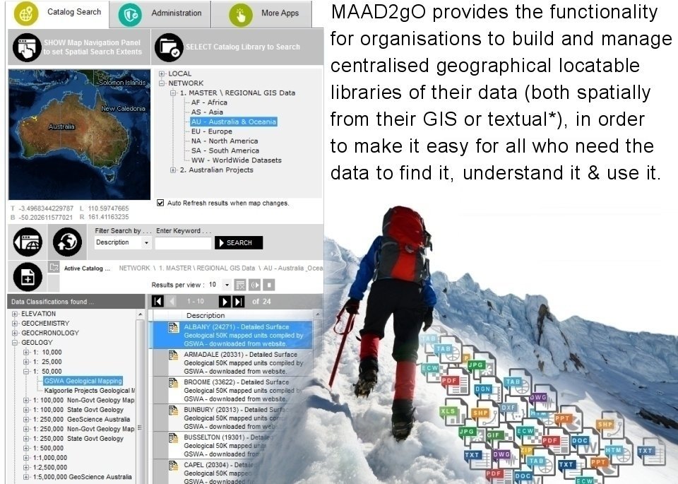
* GIS - Geographical Information System common file formats [ MapInfo .tab, ESRI Shapefiles .shp, Microstation .dgn, AutoCAD .dwg & .dxf, .ecw, .Geotiffs .tif ]
Textual - Non spatially locatable files [ Microsoft Office suite .doc(x) .xls(x) .ppt(x), Adobe .pdf, Image formats .jpg .bmp .gif, plus more files based on file extensions ]